|
|
Ordnance Reef Area Map
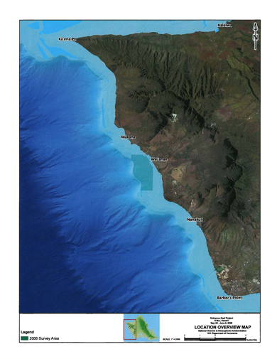
Ordnance Reef (Site HI– 06), is an area of shallow fringing reef measuring approximately 4.2 km by 2.2 km along the Waianae coast of Oahu, Hawaii, which was used as a disposal area for discarded military munitions (DMM) following World War II (WWII). Site HI– 06 has been the subject of multiple investigations; these include an inventory of munition items present conducted by the U.S. Army Corps of Engineers (USACE) in 2002 and a screening-level risk investigation conducted by the National Oceanic and Atmospheric Administration (NOAA) and the University of Hawaii (UH) in 2006.
Ordnance Reef (Site HI– 06), (Unexploded Ordnance as indicated on NOAA’s nautical chart 19340), lies on the western, leeward side of O’ahu and covers an area of approximately 1 nautical mile in length by 0.5 nautical miles in width, and lies in approximately 10 - 70 meters of water. The nearest Hawaiian cities are Wai’anae, which is approximately 3 miles to the northeast, and Maili, HI, approximately 5 miles to the east.
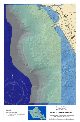
The Map above depicts ocean monitoring sensors that have been placed to support ocean monitoring efforts. Nine ADCPs will be installed adjacent to the disposal site. The mooring locations have been chosen by NOAA and UH oceanographers to provide the greatest benefit to the computer models. NOAA representatives working with the Waianae community to gain local knowledge of the intended mooring locations and through discussions between the oceanographers and local fishermen, it was decided that more ADCPs moored in the Ordnance Reef study area would greatly improve project results, and additional ADCPs were added to the overall project plan. The deep water sensor string moored in approximately 2,400 m of water has five ADCPs, and each of the four shallow water trawl resistant platforms contains one ADCP. Two of the shallow water platforms are located in 91 m of water, while the other two shallow water platforms are deployed closer to shore in 15 m of water. The yellow circles represent the ADCP Locations.
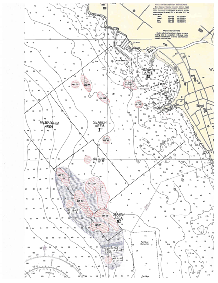
At the request of Army Corps of Engineers, the Explosive Ordnance Disposal Detachment (MIDPAC) (UIC-32082) from Pearl Harbor, HI planned to conduct a diver survey to determine the various amounts and types of military munitions in Pokai Bay on the western coast of O’ahu, HI. The survey for military munitions was scheduled to begin September 2001 but was put on hold until July 2002 due to the events of September 11, 2001. Diving operations began on July 18 and continued until July 25, 2002. The search method employed was diving a course heading the length of the study area, with course corrections sent from the surface to ensure accurate runs. Each run was 100 yards apart. Due to the water clarity this was deemed sufficient to get a general evaluation of the overall search area. Bounce dives were conducted on the deepest surveyed area just outside of the third section to try and determine the extent the military munitions disposal site. Contacts were reported and marked using global positioning system (GPS).
|
| Copyright © 2011 Ordnance Reef Hawaii | |